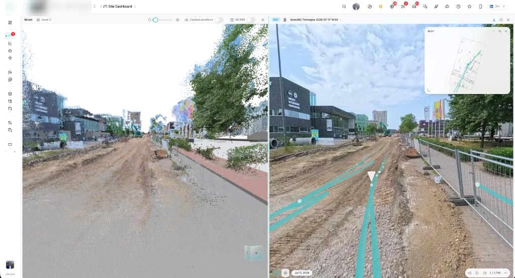
Bimefy spatially aligns the 360° walkthrough with the BIM model, allowing the project team to view what was built and what was designed from corresponding positions.
At a given location, the team can visually compare the 360° capture with the corresponding BIM view.
At that same location, earlier walkthroughs remain available so the team can see how the works changed.
Every new walkthrough adds another dated state of the same location, still connected to the BIM model.
A 360° walkthrough provides a detailed record of what the construction site looked like at a particular moment, while the BIM model represents what was designed. The challenge is connecting those two sources.
When the capture and model are viewed separately, understanding whether a specific location corresponds with the design requires additional interpretation. The same applies over time: multiple walkthroughs only become truly useful when the team can return to the same location and compare how it changed between different capture moments.
APK Wegenbouw and its partners wanted to connect those views directly.
The partners record the site in 360°, upload each walkthrough to Bimefy, align it with the BIM model, and then review reality and design together from corresponding positions as construction progresses.
The project team records the works as a 360° walkthrough and uploads the capture to Bimefy. Each capture becomes a dated visual record of the site at that stage of construction.
The walkthrough is spatially calibrated against the BIM model so positions along the capture route correspond with positions in the model.
The 360° view and BIM model can be viewed side by side from corresponding positions. This lets the team visually compare what is on site with what was designed.
As construction progresses, new walkthroughs are added. The team can return to the same part of the building and review how that location looked at different stages of the project.
What this looks like in Bimefy
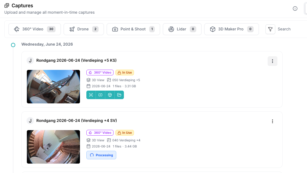
Site captures are processed into navigable walkthroughs inside the project.
Positions in the walkthrough are connected with corresponding locations in the BIM model.
Reality and BIM can be viewed together from the same project location.
Every walkthrough remains available as a dated state of the construction site.
Captures can be organized by building level to keep large projects manageable.
Project partners work from the same model and the same reality captures.
APK Wegenbouw and its partners can move to a location in the project and review the corresponding 360° site view alongside the BIM model.
This makes the relationship between what was designed and what was visible on site much easier to inspect.
Because new walkthroughs are added as the works progress, those same locations can also be revisited at earlier moments. The project therefore builds up a spatial and visual history of the construction, rather than a collection of disconnected site photos.
Construction elements are often covered by later works. Because earlier 360° walkthroughs remain connected to the model, the team can return to a previous capture and review what was visible at that location before it was closed up.
Capture the site in 360°, connect each walkthrough to the BIM model and return to the same location at every stage of construction.






Trusted by innovation driven companies
See how other construction teams work with Bimefy
A large main contractor uses Bimefy as its Common Data Environment to move project information from WIP to Shared to Published through controlled approvals.
View use caseOn one of its projects, a contractor uses Bimefy to connect site captures with the BIM model and the project planning, so the team can see how the works are progressing.
View use caseA large contractor combines dedicated Bimefy cameras with its existing security cameras, which share a scheduled site image once an hour, so project stakeholders can see more of the construction site from one project environment.
View use case